#herecomestheflood

Dikes but also dunes are an important part of our fight against water. But these two alone will not protect us from floods. That is why the Delta Plan in the Netherlands and the Sigmaplan in Belgium are realised. Both plans contain measures to make the river and sea environment more climate-proof. If they did not, the Geopark map would now look very differently.

Locaties deltawerken (Rijkswaterstaat)

Deltaplan

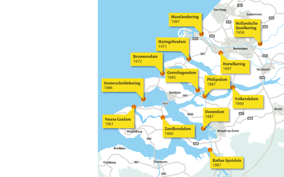
During the 1953 flood disaster, the need for a planned approach to prevent a flood became apparent. Twenty days after the flood disaster, the Delta Commission was established and came up with several recommendations. From these recommendations, the most visible project in Zeeland was the Eastern Scheldt storm surge barrier (Oosterscheldekering). This barrier closed the Eastern Scheldt with sliding doors that could only be closed during storms and high water levels.

Projecten in het Sigmaplan (Sigmaplan.be)

Sigma Plan

Awareness in Flanders for a systematic plan arose from a 1976 flooding of (among others) Ruisbroek. The Sigma Plan is deployed to make more than 260 kilometers of river land climate-proof until 2100. In addition, the Sigma Plan focuses on achieving European nature goals by, for example, giving room for the river in a designated nature reserve.

Here Comes the Flood - Rem van den Bosch

#herecomestheflood

Hoping to raise awareness, but also change behavior, Rem van den Bosch has found a creative way to visualize the bleak reality. At numerous locations in the Geopark, a model indicates how high the water would rise without the measures that protect us from it. The models wear clothing that refers to the Zeeland costume, the part of Geopark Schelde Delta most vulnerable to the sea.