This detour, a walk of 8.9 kilometers (including extension at the point of choice) along the most striking sights of Waarde, has been put together by villagers. For this detour (purple line on map) follow the yellow directional signs with the logo of The Cistercian Detour. You can also extend the route via the other (node) numbers of the walking network.
Waarde, formerly large salt marsh area "Wilmarswaard", became the property of the Cistercian abbey of Ten Duinen in 1187. Shortly before 1200 the area of Waarde and built on the highest part a Gangria; a monastery farm , in the vicinity of the castle of the lords of Waarde. The Cistercian monks played a major role in the construction of the village.
-
Mill De Hoed
This mill was built before 1550 in Ghent, Belgium, as an oil mill and converted to a grist mill around 1700. It was not until 1989 that the mill came to Waarde, and was rebuilt and restored. In 1993, the mill was officially opened by Prince Claus, together with the village's former miller, Mr. J. Wagenaar (name mentioned on bench on the mill grounds). The mill is owned by the De Hoed Mill Foundation. It is the only open standerd mill in South Beveland. In 2015, Princess Beatrix honored the mill with a visit on Zeeland Mill Day.
-
Old port on de Schaar
The small harbor ceased to exist in 1847 as a new suation lock was built. A new tide port was constructed in 1860 and was mainly used as an agricultural harbor. The suction sluice located behind the dyke (since 1958 with the electric pumping station Waarde), drains through the harbor. The Western Scheldt estuary provides access for large cargo ships to the port of Antwerp.
-
Coupure
In the Havenstraat, at the exit to the Westveerpolder, there is a cutoff. This can be closed at extremely high water levels by wooden beams, located under a canopy on the causeway. Only once after the disaster, on January 2, 1977, were the coupure beams used and there was a reinforced dyke guard.
-
Former town hall
Waarde was an independent municipality until the end of 1969. Last mayor was J.D. de Kam. The town hall is now a residential house with a beautiful double wooden front door with carvings and arched drum with inscription "Town Hall" and Art Nouveau motifs. Behind the town hall was the safest place during high water, also called the Mount of Refuge (Vluchtberg).
-
The Reformed Church
Around 1222, the parish of Waarde was founded by the Cistercians. The church was built about 1380. In the middle of the 17th century, a small burial chapel was added with a tomb of Gillis van der Nisse, craftsman lord of Waarde. The old tower bell was removed by the Germans in World War II. In 1949, a new tower bell was installed, weight 950 kg. The inscription on the edge reads: "I call to church, Rule the work, Proclaim' death, Warn in distress, I speak also with me, At feast and feast". On the fence in front of the church hangs the coat of arms of Waarde.
-
War Memorial
This monument commemorates the crash of an English plane, a Lancaster bomber, on April 11, 1944. Five pilots and three villagers died in this crash. The English pilot John Moore parachuted from the burning plane into a tree and survived the accident. At the unveiling of the monument, by Prince Bernhard on 31 March 1984, this pilot was present. The monument contains the names of the eight people who perished.
-
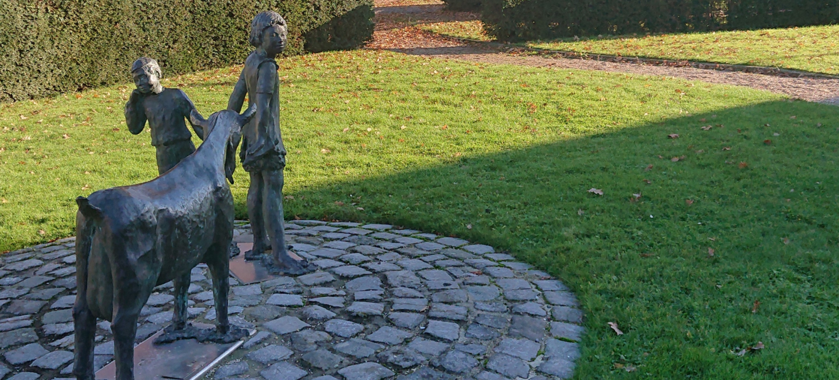
‘t Ouddorp
In 't oudurp (now Parkzicht) we see the bandstand, built in 1930. In the past this was also the vaete; a drinking well for cattle and served as a fire pit. On the lawn around the bandstand are benches and a beautiful sculpture group of two children with a goat, by sculptor Frida van Overbeeke-Verschuur, placed in 2004. The oak tree predates the flood disaster.