Smalle Beek Valley

The stream valleys of Smalle Beek and Het Loopje drain to the north, according to the general slope of the landscape. In the Smalle Beek area, very old clay and sand layers lie close to the surface. About 2 million years ago, at the beginning of the Pleistocene, the area was part of a large estuary of Rhine and Meuse, into which rivers from the Scheldt basin also flowed from the south. In this estuary, between 2 and 1.6 million years ago, an alternation of sandy and clayey layers was deposited that now lie a few meters below the surface (Waalre Formation).

51.502099219966, 4.3725867

Geological map of the geosite

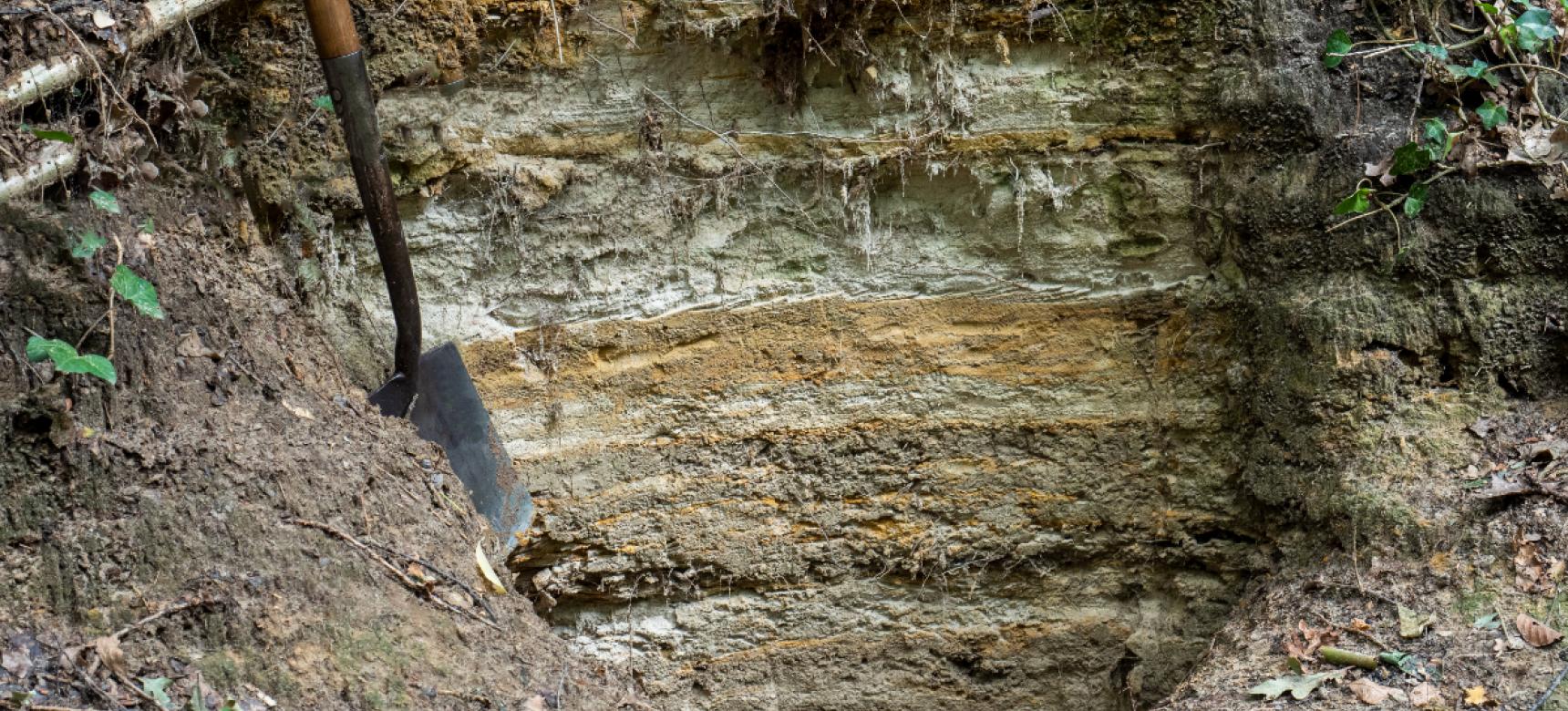
Erosion during the Pleistocene ice ages

After the deposition of the Waalre Formation, the courses of Rhine and Meuse moved out of the area. From about 1 million years ago, West Brabant gradually rose and most of the deposits from the Scheldt Basin were eroded again during successive ice ages. In the Smalle Beek area, remnants of these old Scheldt deposits of several meters thick still occur here and there. Of the long period of 1.5 million years between these Early Pleistocene deposits and the cover sand from the last ice age, usually only a thin layer of gravel remains at the interface between the two. This gravel layer is the last remnant of the thick packages deposited by the rivers from the Scheldt Basin on top of the Waalre Formation more than a million years ago. The gravel, also called "Scheldt gravel," remained after the finer parts of these deposits were washed away by streams or swept away by wind.

The end of the last ice age

At the end of the last ice age, western Brabant was part of a vast polar desert with an upper layer of cover sand. The streams flowed through wide valleys and had a "feral" or "braided" course with many gullies that carried a lot of water in a short time but were dry for much of the year. During the summer, much water was released and quickly drained at the surface along with sand and loam. During the Late Glacial, from about 14,500 to 12,000 years ago, the climate began to warm and vegetation increased. As a result, the streams changed to meandering watercourses with a single stream channel and distinct bends. During wet periods, streams still experienced large peak discharges, which caused them to cut into the subsoil. Therefore, in the valleys of Brabant brooks we find under the present brook valley bottom a deep narrow channel that even in small brooks such as the Smalle Beek can be six meters deep but only a few dozen meters wide.

Het Holoceen

With the rapid climatic improvement at the beginning of the Holocene, about 12,000 years ago, water runoff decreased greatly. As a result, the stream valleys gradually filled with fine deposits such as sand, loam and peat. These flattened the relief so that even the deep incision from the Late Glacial is no longer visible in today's landscape. The naturally meandering course of many brooks in Brabant has been straightened by man. This also happened in the 1930s with the Smalle Beek and the Loopje.